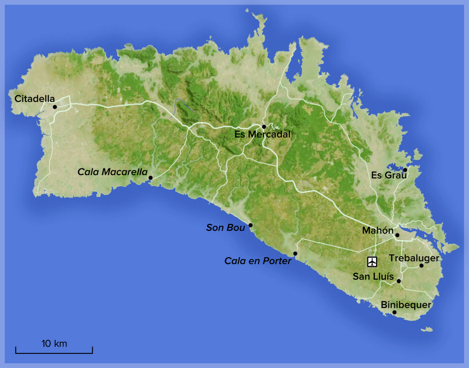
Maps for tourism magazines
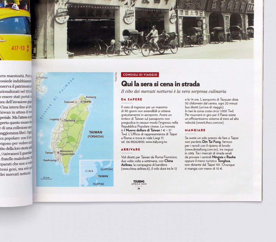
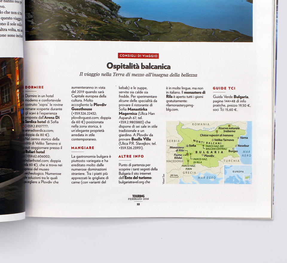
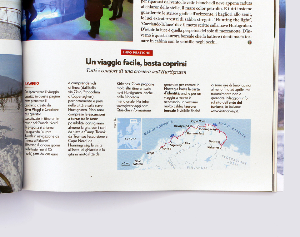
Creation of maps for the itineraries of a tourism magazine.
Cliente: Touring Club Italiano
Itinerary for guides
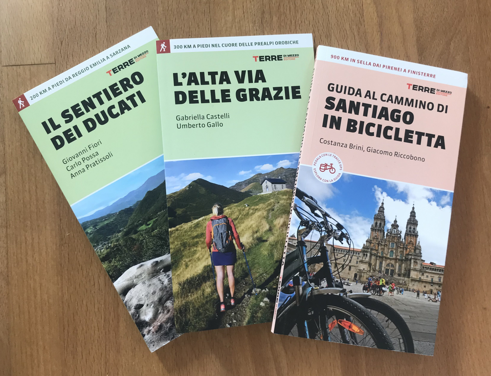
Realization of the cartography for the guides published by Terre di Mezzo Editore
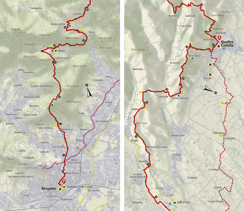
Maps for the first stage of the guide "L'alta via delle grazie"
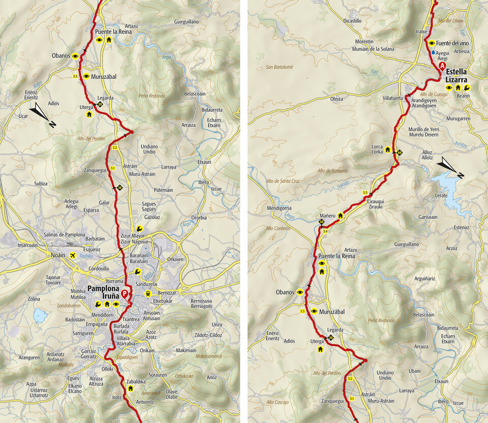
Maps for the third stage of the guide "Cammino di Santiago in bicicletta"
Maps with 3D effects
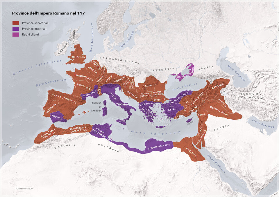
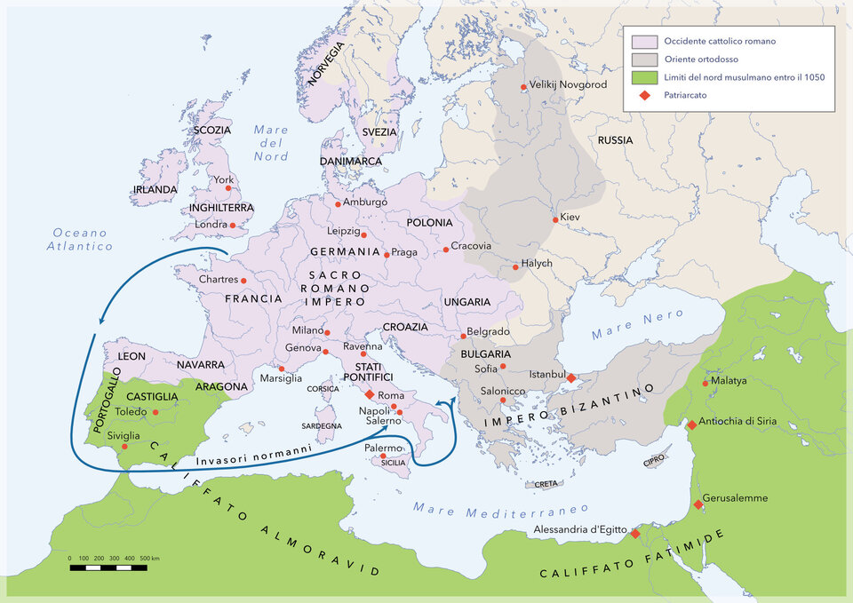
Historical Maps
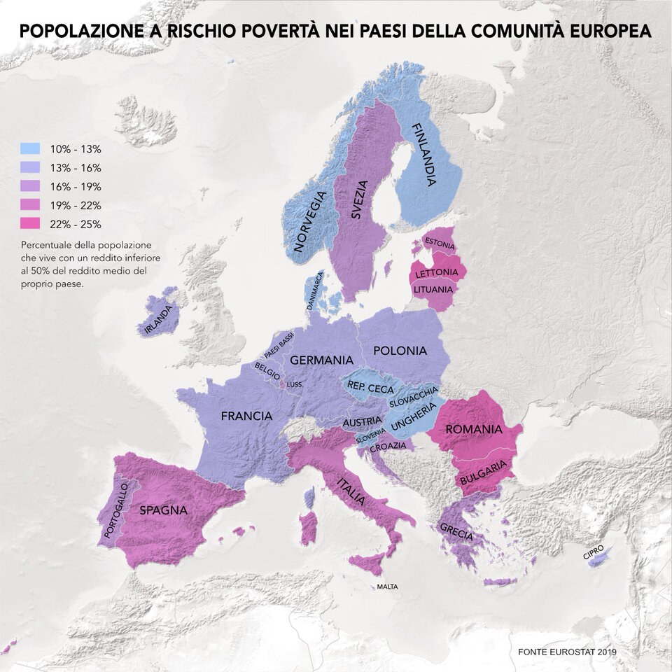
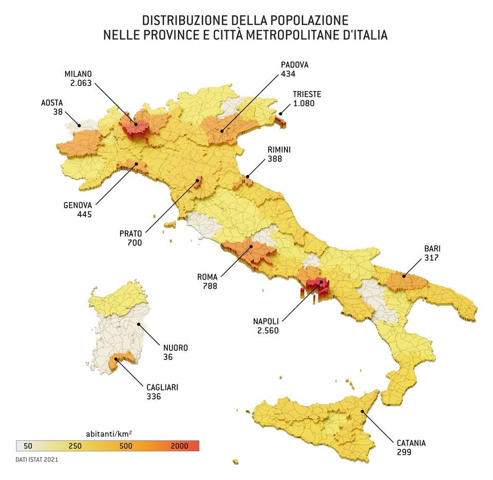
Maps for geostatistics
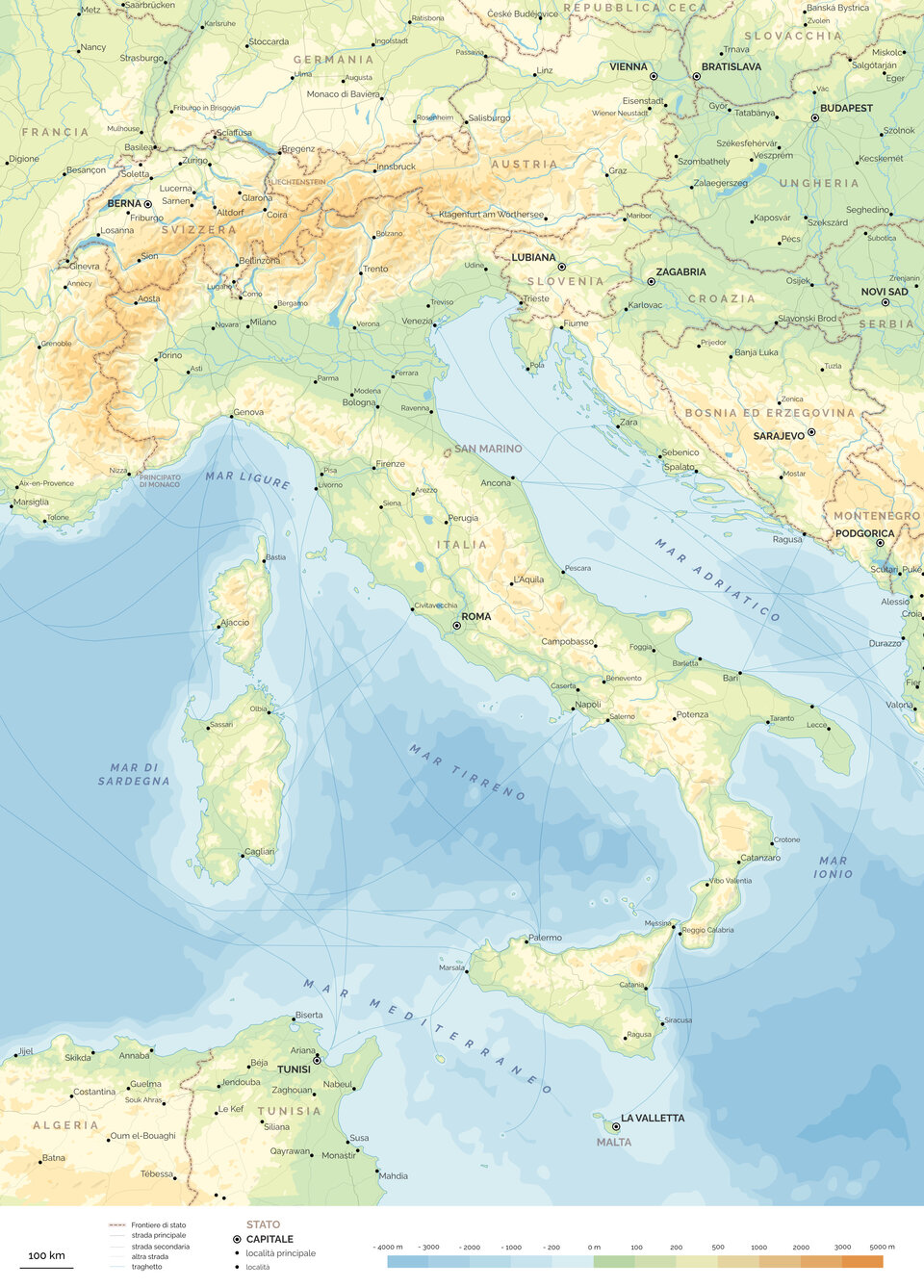
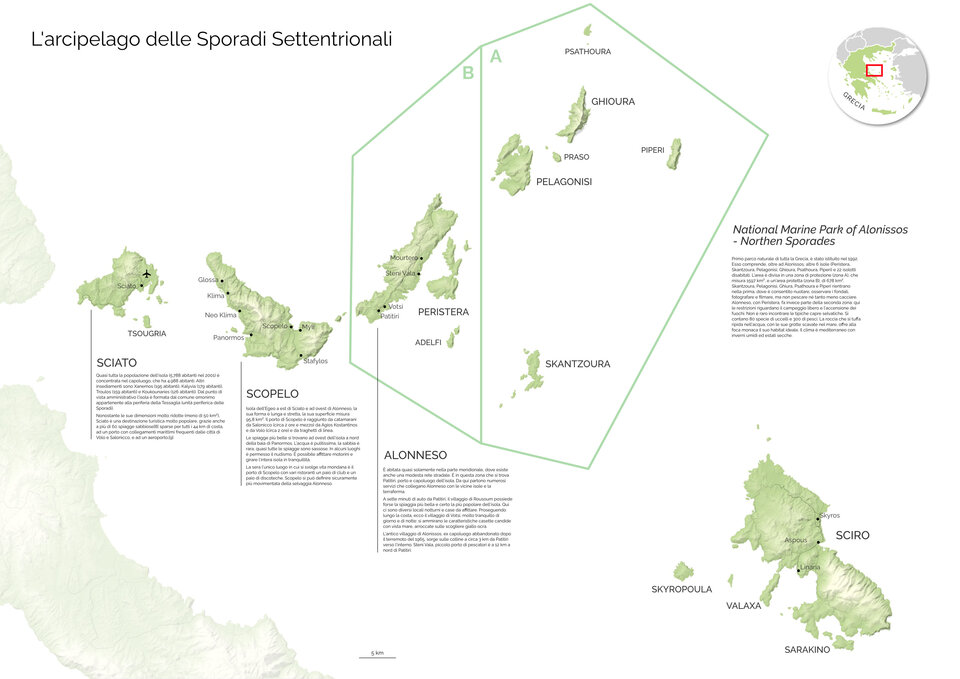
Various Maps
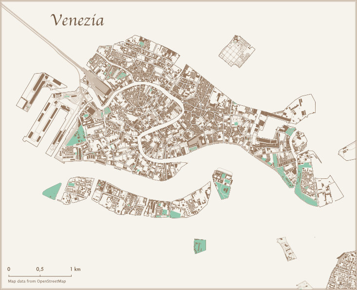
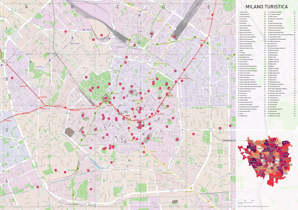
City maps
Illustrated Maps
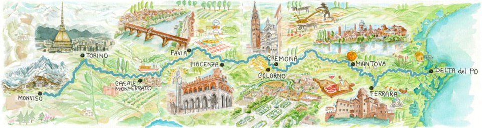
Itinerary along the Po river.
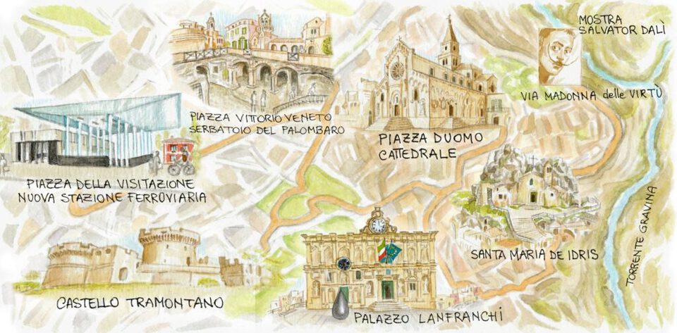
Matera capital of culture 2019.
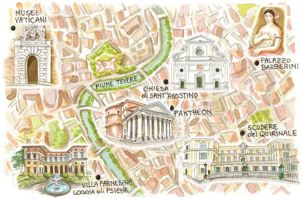
Raphael's Rome
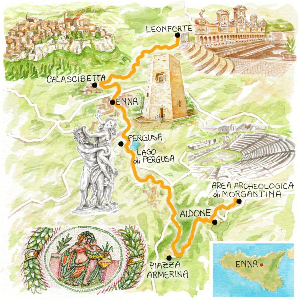
In the center of Sicily.
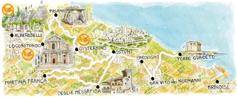
The orange villages of the Itria Valley in Puglia.
Illustrations at ecoline for Touring magazine
Cliente: Touring Club Italiano
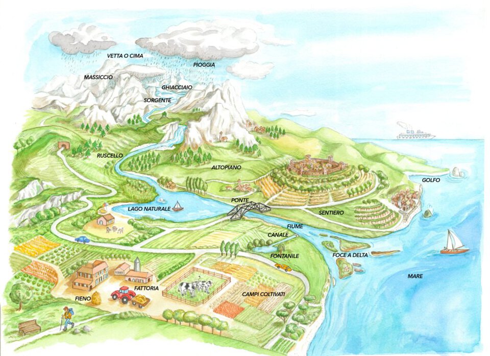
From the mountains to the sea: the formation of water.
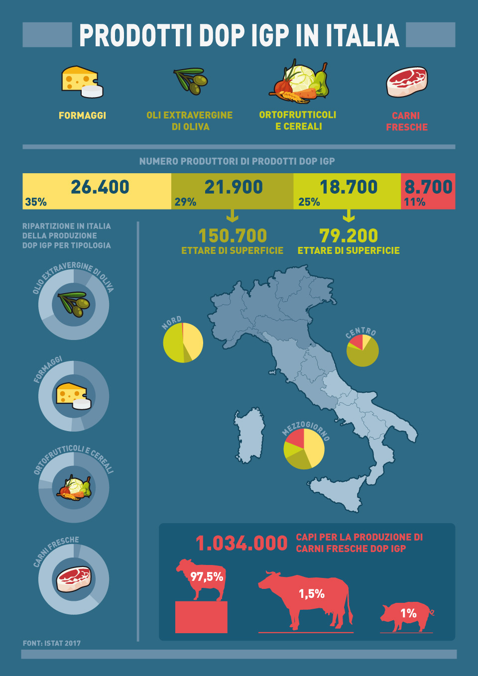
Infographic